All about Rizal
Laguna de Bay Explained: The Lake You See From City on a Hill
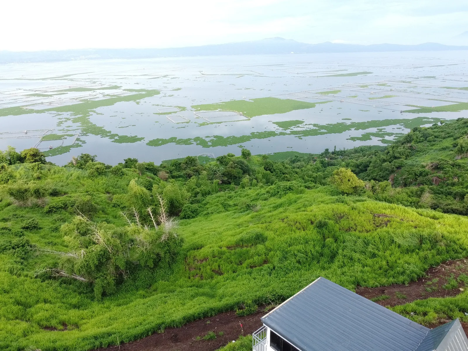
Laguna de Bay is the Philippines' largest lake, about 911 to 949 km² and only 2.5 to 2.8 m deep on average. What you see from the villas: Talim Island, fish pens, the Pililla turbines and the far shore.
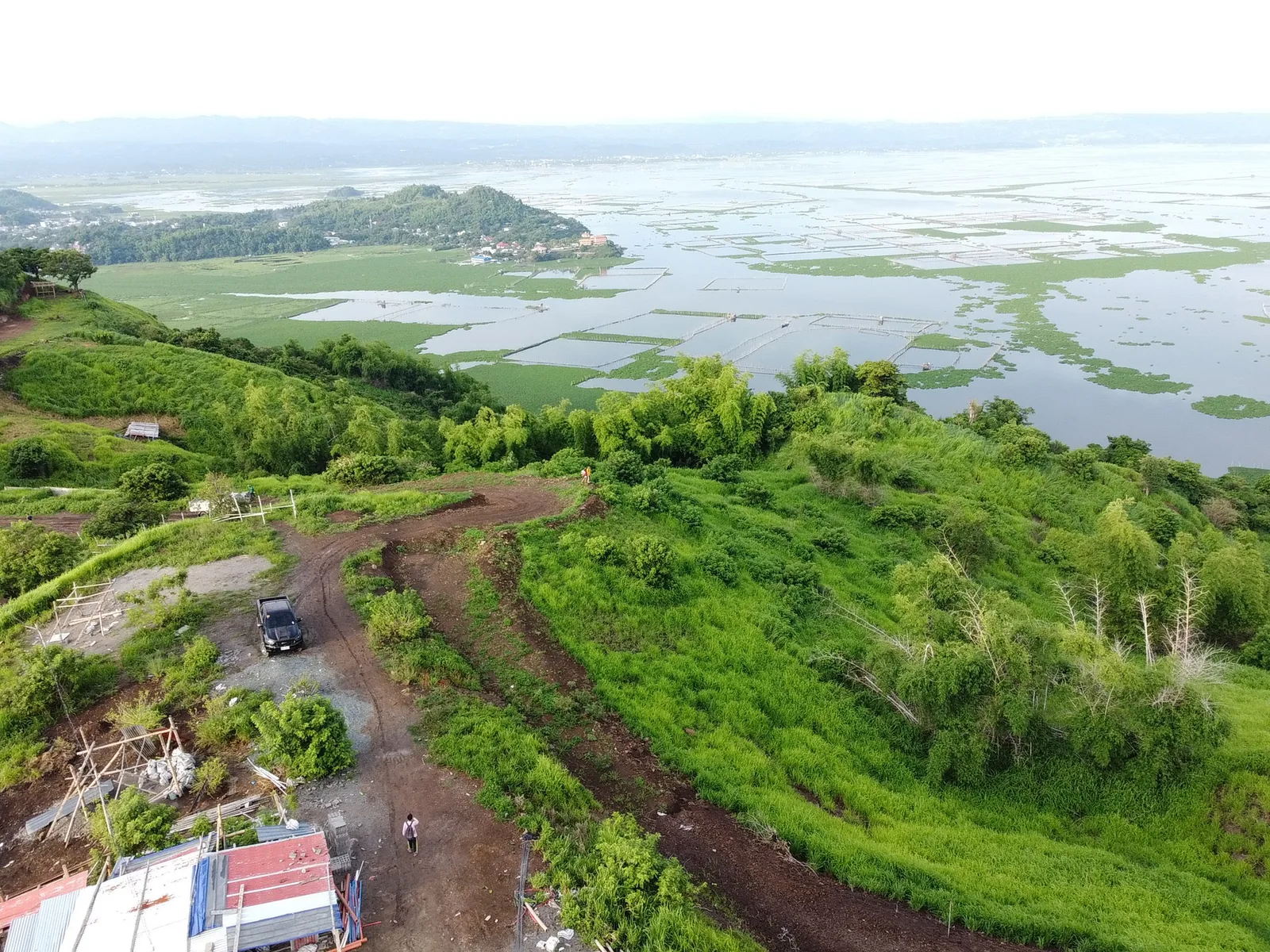
Laguna de Bay is the largest lake in the Philippines, about 911 to 949 km², and the view from City on a Hill Private Villas in Mahabang Parang, Binangonan, looks straight across it. It is shallow, only 2.5 to 2.8 m deep on average, fed by 21 major rivers and drained to Manila Bay by the Pasig River through the Napindan Channel.
Lake facts at a glance
| Laguna de Bay | |
|---|---|
| Area | About 911–949 km² |
| Average depth | 2.5–2.8 m; deepest about 20 m at the Diablo Pass |
| Size | 47.3 km east to west, 40.5 km north to south |
| Rank | Largest lake in the Philippines; third-largest inland water in Southeast Asia |
| Outlet | Pasig River via the Napindan Channel |
| Managed by | Laguna Lake Development Authority (LLDA), created in 1966 |
What can you see from the villas?
- Talim Island: the lake's largest island, with Mt. Tagapo as its highest point.
- Fish pens: the grids of bamboo poles on the water; fishery is one of the lake's main uses.
- The Pililla wind turbines on the eastern ridge, and the Sierra Madre beyond.
- The Metro Manila skyline to the west on clear evenings.
How can you get closer?
The Binangonan fish port, about 3.4 km from the villas, is where boats leave for Talim Island; see the Talim Island guide. For a lakeside meal, read lake-view restaurants, and for which villa faces which part of the lake, the views from each villa.
How the lake is used
- Fishery: fish pens and cages across the lake, the bamboo grids you see from the villas.
- Transport: boats to Talim Island from Binangonan's fish port.
- Water and power: the lake supplies the Kalayaan pumped-storage hydroelectric project, and new water-treatment plants are planned along its shores.
- Flood control: the Napindan Hydraulic Control System, built in 1983, regulates flow between the lake and the Pasig River.
Rizal towns on the shore
| Town | From the villas |
|---|---|
| Binangonan | About 3 km |
| Cardona | About 5.4 km |
| Morong | About 7 km |
| Baras | About 12 km |
| Tanay | About 15 km |
| Pililla | About 19 km |
Swimming
Swimming in Laguna de Bay itself is not recommended because of pollution and heavy fishing use. Enjoy it from above: the villas' infinity pools sit over the view.
Compare the three villas or check open dates and rates.
Sources
- Wikipedia: Area, depth, tributaries, outlet, LLDA, Talim Island
- Drive distances: free-flow road routes from the villa entrance, computed with OpenStreetMap routing on 15 October 2026.
Frequently asked questions
How big is Laguna de Bay?
About 911 to 949 km², the largest lake in the Philippines and the third-largest inland body of water in Southeast Asia after Tonle Sap and Lake Toba.
How deep is Laguna de Bay?
Shallow: about 2.5 to 2.8 m on average, with a maximum of about 20 m at the Diablo Pass.
What island is in the middle of Laguna de Bay?
Talim Island, the lake's largest and most populated island, shared by Binangonan and Cardona.